New DJI Technology Offers a System to Track and Identify Drones

Over the past few years, drone technology has improved dramatically. With all of the updates, the amount of drone pilots have also increased tremendously. Drones are being used for many business solutions and are even in the process of being used to assist with emergency calls. Enthusiastic drone hobbyists are also increasing by the day because of all the neat features and video technology that is now offered.
With the increase of drone usage and the upward trend of piloting drones, it is going to be important that drones are able to be tracked and identified. Cars and other motorized vehicles that are on the roads require that they are registered with the government. This holds operators accountable for their actions when they are behind the wheel. Since drones are becoming popular and beginning to populate the skies, it is important that the owner/pilot of each one is able to easily be determined should the drone be used in an illegal activity or cause damage to any property.
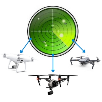
Since the China government has decided to increase their regulations on drone usage, DJI has launched a new technology that will track and identify drones. These devices will come in handy when a drone is being flown in a sensitive or restricted area, and two have already been installed at an airport. This will not only deter pilots from flying their drones in these areas, but will also identify them and give law enforcement the ability to hold them accountable.
Once these new systems by DJI technology are installed, they will be able to send a frequency that will collect the data from drones being flown in airspace where they are restricted. Information provided to the system will include the drone’s location, flight direction, altitude, speed, and identification information such as its registration or serial number. These bits of information will allow the drones to be easily identified when they are being flown in restricted areas. It is anticipated that law enforcement, security agencies, and airports will install these tracking systems.
Once the this new DJI tracking and drone identifying system is powered on, it can immediately sense any drones that are in the area. As soon as the drone is picked up by the system, it’s registration information is sent and it is plotted on a map. The detection system is able to pick up information on drones that are registered, which covers almost all DJI drones because of a law that China introduced a few months ago that determined all drones weighing more than 250g would require registration.
This new system is currently being used at two undisclosed airports in China, but is anticipated to be of important use within the United States soon. As the U.S. continues to raise the restrictions on drones, the need for them to be registered will become more important. Currently there is a restriction for flying drones over major landmarks within the United States, so this new tool will definitely prove to be useful.


no registration, just another way for the damn government to control
your every move…. if they flying over my house or property
it is considered trasspasing and will be shot down
And will DJI have any protection for DJI Owners against our profiles being stolen by the Bad Guy’s I think DJI is opening a can of worms if they do that! I am seriously thinking of getting rid of all of my DJI PRODUCTS!! they aren’t the only game in town!!
China is one thing…this is the USA. Big Brother does not monitor cars, etc., so
something like this scheme is best left over there. One cannot fix stupid and no matter what the rules there will always be some idiot who just can’t seem to get it. Lowering everyone to that standard is unacceptable. Punish the scofflaws, the ne’er do wells and the idiots. Leave the rest of us alone.
Same thing happened back in the day with Wave Runners and other marine scooters. Operators flouted laws and regulations especially regarding speed limits near shore and use of designated swimming areas and ski lanes. An oft-heard cry was that there was no fun in showing off to one’s buddies on shore if one were restrained to 50 or 100 yards offshore. This attitude is prevalent among many drone operators who seem to think they don’t have to abide by rules and regulations designed to protect and facilitate the safe use of airspace by all users. My guess is that these unprincipled users will be thinned out eventually.
They’d better have a much better system than B4UFLY to determine “where you can fly”. I get three different answers from three different providers and B4UFLY keeps telling me I need to call the tower at a Regional airport (DAL) that is 6 miles away, a local airport (Addison) that is 8 miles from me and an International (DFW) that is 17 1/4 miles away. No offense but no aircraft landing at any of those airports is going to flying 200 ft over my house when Airmap doesn’t! I get it, I really do with yahoos out there going for distance (out of line of sight) and altitude records with their hobby drones, but most of the time I will be flying below the tree-tops in my yard or doing a 10ft “follow-me” as I walk my dog around my neighborhood. Like I say, I get it. I’m not going to endanger anyone. I can hear a copter much sooner than I can see it and, if so, I’m hitting the ground. So a little reality, latitude and common-sense had better be cooked into the books at DJI before they start going all 1984 on us.
There is a need for safety, but the government have a tendency to over reach. Thus there should be committees that is a aenaqble approach and put barriers to policy that doesn’t apply to safety. Airport radar systems are perfect because this is a real danger. Even further planes should be equipped with such equipment to auto deter drones safely. This would require any maker of flight controllers to build in special cmos chips code that can’t be tampered. This way the ability for those that want to deter the safety system will be very low causing a lower risk.